Tax included.
RUGGED GPS TOUCHSCREEN NAVIGATOR WITH inREACH® TECHNOLOGY AND 8-MEGAPIXEL CAMERA
Get advanced outdoor features, inReach satellite technology for two-way messaging and interactive SOS alerts plus a built-in camera — all housed in a rugged 5-inch format ideal for navigation on foot, bike, kayak, ATV and more.
Features:
- Navigate easily with a display that’s designed to work even when wearing gloves.
- Explore with detailed, routable maps featuring landmarks, terrain, and more.
- Use inReach messaging for two-way communication and activate an SOS with professional emergency response support.
- Capture your adventure with an integrated camera that geotags photos, so you can revisit the exact locations.
- Designed to withstand extreme conditions, this device meets MIL-STD 810 standards for thermal, shock, water, and vibration resistance.
- Access vivid satellite imagery showing detailed overhead views of your route for enhanced navigation.
WHAT YOU'LL LOVE
-
Global Connectivity
Stay connected off-grid with an active inReach subscription. Messages, SOS, and tracking are transmitted via the 100% global Iridium® satellite network, bypassing the need for cellular coverage.
-
Built-In Camera
Document your adventures with the Montana 760i’s 8-megapixel autofocus camera. Geotagged photos allow you to navigate back to favourite sites in the future.
-
Rugged by Design
Built to endure extreme conditions, this water-resistant handheld meets MIL-STD 810 standards for thermal, shock, water, and vibration. Its glove-friendly 5-inch touchscreen and compatibility with robust mounting solutions (sold separately) make it adaptable to your activities.
-
TopoActive Maps
Explore with preloaded worldwide topographical maps featuring terrain contours, elevations, coastlines, rivers, and landmarks.
-
Satellite Views
Download high-resolution satellite imagery directly to your device over Wi-Fi®. Enjoy photorealistic overhead views of routes and terrain for precise navigation and waypoint creation.
-
Outdoor Maps+
Upgrade with a subscription to Outdoor Maps+ (sold separately) for premium mapping content and regular updates, delivered via Wi-Fi technology.
inREACH FEATURES
-
Two-Way Messaging
Exchange text messages with loved ones back home, or communicate device-to-device with other inReach users in the field.
-
Interactive SOS In case of emergency, trigger an interactive SOS message to Garmin ResponseSM, a 24/7 emergency response coordination centre.
-
inReach Weather
Receive detailed weather forecasts directly to your Montana handheld or paired devices, so you’re prepared en route.
-
Live Tracking
Share your journey with followers on a live tracking page. They can see your progress, ping your device to view your location, and exchange messages during your trip.¹
NAVIGATION FEATURES
-
Garmin Explore™ App
Plan and review your trips, manage waypoints, courses, and activities by pairing with the Garmin Explore app.
-
Multi-GNSS Support
Access both GPS and Galileo satellite networks for more reliable tracking in challenging environments.
-
ABC Sensors
Use altimeter, barometer, and a 3-axis electronic compass for advanced navigation on your next trail.
-
City Navigator® Maps
Effortlessly switch from trails to roads with preloaded City Navigator street mapping, providing turn-by-turn driving directions.
-
Additional Maps
Expand your map library with 32 GB of onboard memory. Download extra maps, like BlueChart® g3 charts for marine navigation (sold separately).
-
Active Weather
Get up-to-date weather forecasts via the Garmin Connect™ app on your compatible smartphone.
-
Dog Tracking
Sync with compatible Astro® or Alpha® handhelds to track sporting dogs during hunting or training activities.
-
Wikiloc Trails
Access preloaded trails from Wikiloc, including hiking, cycling, and other outdoor routes. A free 60-day Wikiloc Premium trial is included for exclusive features.
ADVENTURE FEATURES
-
Public Land Boundaries
Display federal public land boundaries on topographic maps to ensure you're staying within legal areas.
-
Expedition Mode
Use Expedition Mode to extend tracking for over two weeks on a single charge with an ultralow-powered GPS reference.
-
Battery Options
Enjoy up to 24 hours of GPS mode battery life with a rechargeable lithium-ion battery pack, charging via USB-C®.
-
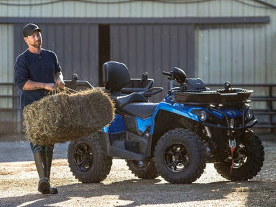
Vehicle Mounts
Use compatible vehicle mounts (sold separately) to adapt your Montana handheld for ATVs, boats, cars, motorcycles, RVs, or other vehicles.
Compatible Products:
- Outdoor Maps+ Annual Plan
- Bicycle Handlebar Mount
- Suction Cup Mount with Speaker